
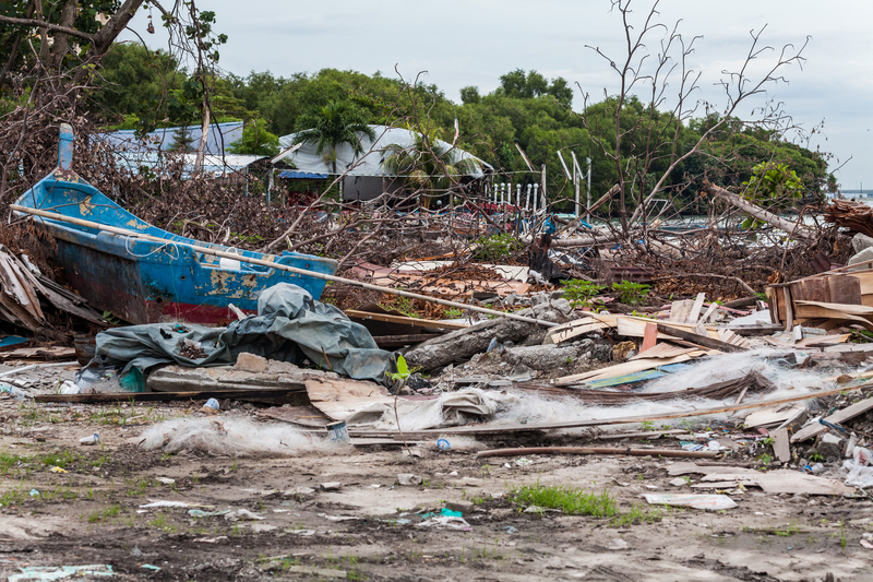
Almost every type of disaster will result in debris, particularly hurricanes and other severe storms. Hurricane Ian, for example generated an estimated 31 million cubic yards of debris.
That's the equivalent of ten Great Pyramids of Giza, stuffed to the gills with the wreckage of every type of material and artifact of modern life, and then some.
There are white goods such as washers, dryers, and refrigerators, there is vegetation, construction and demolition (C&D) debris, sandbags, and categories of items too numerous to be named. All must be disposed in their own particular way.
With its sheer volume and complexity, debris collection and disposal is one of the biggest costs incurred in a disaster. Insurance Adjusters International estimates that the cost of removing and disposing debris accounts for 27% of the costs of disaster recovery.Insurance Adjusters International estimates that the cost of removing and disposing debris accounts for 27% of the costs of disaster recovery.
“If you look at Hurricane Ian, the streets were just a mangled mess with debris, and they still are, two months afterwards,” says Carrie Speranza, Director Emergency Management Solutions for Esri a provider of GIS based mapping technologies.
Help from many quarters
Fortunately, there are resources to help communities cope with debris. A Presidential Disaster Declaration, for example, opens the gateway to Federal Emergency Management Agency (FEMA) Public Assistance funds, authorized by the Stafford Act. The program is designated to compensate jurisdictions with a 100% cost share covering the expense of removing debris that is either located on public rights of way, or that poses health or safety risks to the public.
There are numerous contractors eager to take on the job, as well. Speranza explains, “When a storm hits, depending on how big the disaster is and if it was something predictable, you may get dozens and sometimes hundreds and even thousands, of contractors who will swarm into a jurisdiction ready to get to work.”
Coordinating that work requires a lot of monitoring and oversight, she said, adding, “What a jurisdiction cares about in a disaster is making sure the debris is handled in a correct way, because millions sometimes hundreds of millions of dollars can be put in jeopardy if they don't remove the debris in accordance with the FEMA processes.”
"...you may get dozens and sometimes hundreds and even thousands, of contractors who will swarm into a jurisdiction ready to get to work.”
“You have all these contractors and they're ready to do the work, and they want to do it now. But the jurisdiction really needs to make sure they have their ducks in a row and that they can make sure that they would pass an audit.”
Speranza said Esri's Emergency Debris Management Solution, released in June 2021, helps jurisdictions expedite debris clearance, by providing an assessment of debris removal needs. It assists in quantifying the type and volume of debris, and tracking it “all the way through the monitoring and removal process.”
Jurisdictions can begin setting up the forms in the application before the incident even happens, “and it will walk you all the way through long-term recovery, which for debris management can sometimes last for years.”
Surveying the damage
According to Speranza, the debris management mission begins in the immediate aftermath of an incident, with a “windshield survey.” During this time, contracted personnel literally peer through their windshield to see what's come down across the roadways. Using a touch pad or smartphone and the Debris Management Solution interface, they can map the location and description of debris they observe, while uploading photos of the debris, along with their assessment of the health and safety risks. They will also note whether it's in a right-of-way, or blocking an evacuation route.
the jurisdiction may ask residents to deposit storm debris gathered from their properties, at the curbside right-of-way, categorizing and organizing it into piles by type
This information becomes instantly available to the jurisdiction's debris management operations center, where a decision can be made to triage the debris, or to assign urgency to the situation and dispatch the appropriate contractors and equipment to the location. According to Esri, the windshield survey can be lifesaving in the early phases of an emergency response, when clearing roadways is essential to the search and rescue mission.
Later in the recovery, the jurisdiction may ask residents to deposit storm debris gathered from their properties, at the curbside right-of-way, categorizing and organizing it into piles by type; such as white goods on one side and C&D on the other.
Over the course of recovery, the pins on the GIS map “that say we have this much vegetative debris in this location; this much construction and demolition debris, in this location,” drives operational decisions. In fact, if the jurisdiction provides the link, the technology can accommodate input entered by homeowners themselves. The process ensures “the right kinds of vehicles and contractors and equipment are going to the right locations,” Speranza said.
A historical record
One of the great strengths of the Emergency Debris Management Solution, Speranza said, is in monitoring and oversight. There are forms and apps within the application that monitors can use in the field to record the size and composition of the load, along with fields for identifying information on the contractor and the vehicle. “There are similar forms in the application that are used by debris monitors at the at the debris management site,” Speranza explains. “So between the monitor out in the field and the monitor at the site everybody is using the same technology, taking the same pictures, of the same truck with the same license plate. Which streamlines the verification process.”
When FEMA comes through on the back end and asks to verify that a particular truck was there, the jurisdiction can provide the documentation generated by the worker, Speranza said. “You can pull up [the picture] that proves it”, and the debris monitor at the disposal site can corroborate using the same app, adding precision and efficiency to record keeping for eventual reimbursement.
“The geographic approach to emergency management, using this tool, is just one way that jurisdictions can be ready technologically, to handle the complex mission after a disaster,” Speranza said. She recommends that “municipalities consider how technology and ArcGIS can help their processes to make sure that they can get the maximum amount of federal reimbursement on the back end.”
The recovery from Ian continues. FEMA reports that more than $2.97 billion in federal grants, disaster loans and flood insurance payments has been provided to the state of Florida and to households after Hurricane Ian, with FEMA providing $769 million to households and $358 million to the state for emergency response. The U.S. Small Business Administration has provided $1 billion in disaster loans, while the National Flood Insurance Program has paid $793 million in claims. The debris management mission is ongoing and its final cost is yet to be determined.
Photo 94181028 © Lee Chee Keong | Dreamstime.com
Latest from Waste Today
- Mount Vernon, Ohio, city council tightens waste hauling regulations
- Retail associations sign MOU to form producer responsibility organization for textiles in California
- Republic Services partners with EDL to provide RNG for San Antonio buses
- WM opens 12 recycling facilities in 2024
- Plastics recyclers report difficult conditions
- BTS Bioenergy opens Maryland Organics Recovery Center
- Meadow tabs aluminum as key to boosting beauty sector recycling
- LFG-to-energy: Maximizing returns with multitiered methane monitoring


